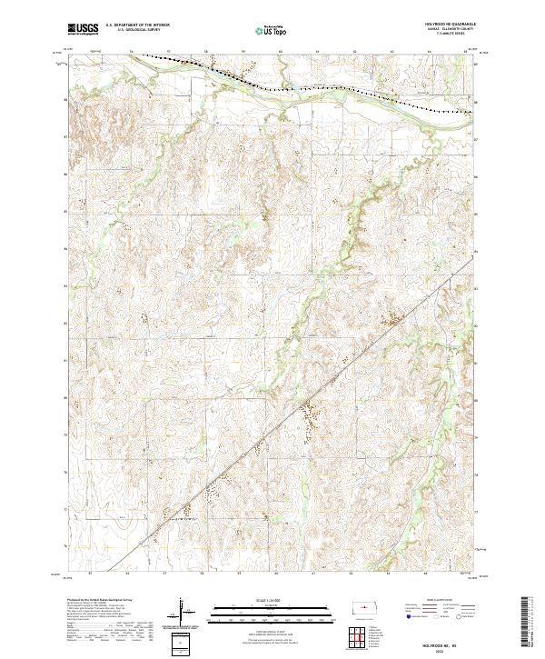
2022 Map of Holyrood NE
USGS Topo · Published 2022About this map
The Smoky Hill River carves across the northern edge of this Kansas landscape, serving as a primary drainage for the surrounding hills of Ellsworth County. This 2022 survey captures a rural environment defined by a dense network of watercourses and the historic legacy of Old Hwy 40, which runs parallel to the river. The terrain is deeply etched by numerous tributaries including Little Wolf Cr, Turkey Cr, and Buffalo Cr, creating a complex series of ridges and valleys. The rectilinear road grid, marked by local routes such as 117th Rd and Ave N, highlights the persistent agricultural structure of the region. This modern topographic record is essential for understanding the contemporary hydrology and land division of the prairie, showing how the drainage patterns of Wolf Cr and Loss Cr continue to shape the local geography.
Find a feature on this map
30 named features on this map. Tap any name to fly to it.
Don’t see what you’re looking for? This feature index may not catch every label — zoom into the map to look around manually.
Map Details
Editions of this 2022 Holyrood NE Map
This is the sole edition of this map. No revisions or reprints were ever made.
Other maps of this area

1894 · Ellsworth
USGS Topo · 1:125,000

1955 · Great Bend
USGS Topo · 1:250,000

1956 · Wilson
USGS Topo · 1:24,000

1957 · Great Bend
USGS Topo · 1:250,000

1957 · Ellsworth
USGS Topo · 1:24,000

1957 · Westfall SW
USGS Topo · 1:24,000

1957 · Holyrood NE
USGS Topo · 1:24,000

1957 · Black Wolf
USGS Topo · 1:24,000

1958 · Great Bend
USGS Topo · 1:250,000
1964 · Holyrood NW
USGS Topo · 1:24,000