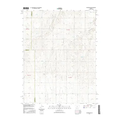
2015 Map of Holyrood NW
USGS Topo · Published 2015About this map
Palacky Cem serves as a quiet landmark at the intersection of rural townships in this section of the Kansas plains. The landscape is defined by the headwaters and drainage basins of several prominent local waterways, including the meandering Blood Cr and Wolf Cr, which carve subtle topography through the agricultural grid. These creeks, along with Spring Cr and Loss Cr, dictate the placement of local thoroughfares like Stickney Rd and Michaelis Rd. The presence of Holyrood Lake indicates modern water management and recreation amidst a region primarily dedicated to large-scale farming. This survey captures the precisely surveyed boundaries where Barton, Ellsworth, and Russell counties meet, reflecting the late 19th-century land division that continues to organize the Central Kansas social and economic landscape today.
Find a feature on this map
26 named features on this map. Tap any name to fly to it.
Don’t see what you’re looking for? This feature index may not catch every label — zoom into the map to look around manually.
Map Details
Editions of this 2015 Holyrood NW Map
This is the sole edition of this map. No revisions or reprints were ever made.
Other maps of this area

1894 · Ellsworth
USGS Topo · 1:125,000

1896 · Russell
USGS Topo · 1:125,000

1955 · Great Bend
USGS Topo · 1:250,000

1956 · Wilson
USGS Topo · 1:24,000

1956 · Dorrance
USGS Topo · 1:24,000

1957 · Great Bend
USGS Topo · 1:250,000

1957 · Holyrood NE
USGS Topo · 1:24,000

1957 · Black Wolf
USGS Topo · 1:24,000

1958 · Great Bend
USGS Topo · 1:250,000
1964 · Holyrood NW
USGS Topo · 1:24,000