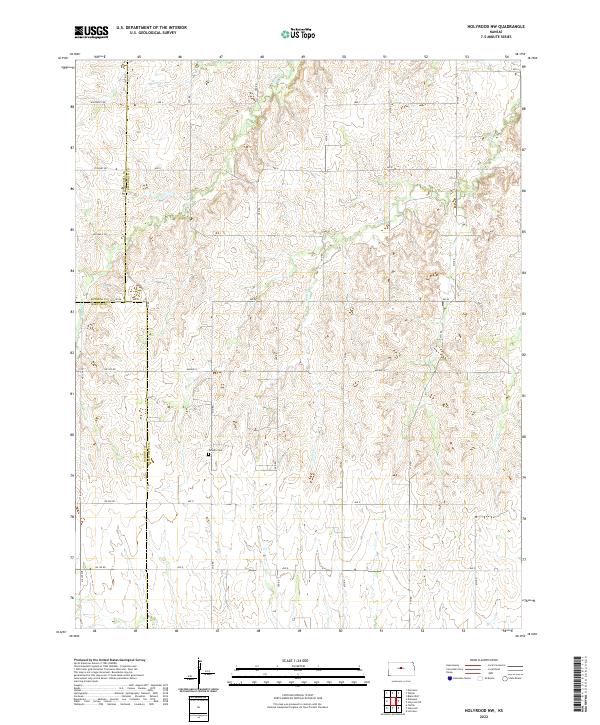
2022 Map of Holyrood NW
USGS Topo · Published 2022About this map
Palacky Cem serves as a central landmark in this rural landscape where the borders of Ellsworth, Russell, and Barton counties meet. The terrain is defined by the dendritic drainage patterns of Wolf Cr, Blood Cr, Spring Cr, and Loss Cr, which carve through the plains. The map illustrates a strictly organized section line road network, with routes such as Stickney Rd, Winterset Rd, and Michaelis Rd framing the agricultural partitions of the late twentieth and early twenty-first centuries. This survey provides a precise record of land division and water management in the Kansas interior, highlighting the intersection of natural hydrology and human-imposed geometry in a region defined by its expansive farm tracts and quiet rural corridors.
Find a feature on this map
22 named features on this map. Tap any name to fly to it.
Don’t see what you’re looking for? This feature index may not catch every label — zoom into the map to look around manually.
Map Details
Editions of this 2022 Holyrood NW Map
This is the sole edition of this map. No revisions or reprints were ever made.
Other maps of this area

1894 · Ellsworth
USGS Topo · 1:125,000

1896 · Russell
USGS Topo · 1:125,000

1955 · Great Bend
USGS Topo · 1:250,000

1956 · Wilson
USGS Topo · 1:24,000

1956 · Dorrance
USGS Topo · 1:24,000

1957 · Great Bend
USGS Topo · 1:250,000

1957 · Holyrood NE
USGS Topo · 1:24,000

1957 · Black Wolf
USGS Topo · 1:24,000

1958 · Great Bend
USGS Topo · 1:250,000
1964 · Holyrood NW
USGS Topo · 1:24,000