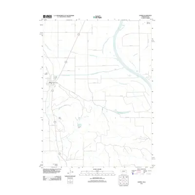
2011 Map of Homer
USGS Topo · Published 2011About this map
Homer serves as the primary settlement on this Nebraska-Iowa borderland, where the terrain transitions from the upland bluffs down into the expansive Missouri River floodplain. The landscape is defined by a sophisticated water management network, including the Pigeon Creek Ditch, Omaha Creek Ditch, and the controlled waters of Overfelt Reservoir held by the Overfelt Dam. Local history is anchored by several long-standing burial grounds, including Saint Cornelius Cemetery, Omaha Valley Cemetery, and the Saint Augustine Mission Cemetery, which speak to the area's diverse community heritage. To the east, the Missouri River meanders near Blyburg Lake, illustrating the shifting hydrology of the valley. This 2011 survey captures the region as a blend of established town life and productive agricultural land, interwoven with contemporary recreational features like the Twenty-Seven Flags Golf Course.
Find a feature on this map
30 named features on this map. Tap any name to fly to it.
Don’t see what you’re looking for? This feature index may not catch every label — zoom into the map to look around manually.
Map Details
Editions of this 2011 Homer Map
This is the sole edition of this map. No revisions or reprints were ever made.
Other maps of this area

1955 · Sioux City
USGS Topo · 1:250,000

1958 · Sioux City
USGS Topo · 1:250,000

1959 · Sioux City
USGS Topo · 1:250,000

1963 · Sioux City South
USGS Topo · 1:24,000

1964 · Sergeant Bluff
USGS Topo · 1:24,000

1964 · Homer
USGS Topo · 1:24,000

1964 · Salix
USGS Topo · 1:24,000

1966 · Walthill
USGS Topo · 1:24,000

1966 · Pender NE
USGS Topo · 1:24,000
1967 · Jackson
USGS Topo · 1:24,000