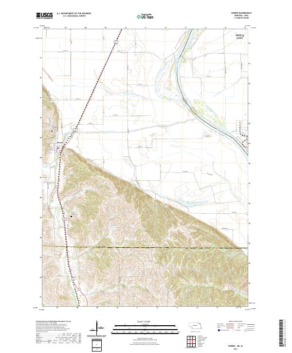
2021 Map of Homer
USGS Topo · Published 2021About this map
The Missouri River defines the eastern boundary of this landscape, where the floodplain of Sioux City transitions into the loess hills of Nebraska. The village of Homer sits at the foot of these elevations, serving as a focal point where the engineered channels of Pigeon Cr Ditch and Omaha Creek Ditch manage the water flow across the low-lying agricultural flats. For genealogists and local historians, the presence of Saint Cornelius Cem and Omaha Valley Cem offers critical points for tracing family lineages in Dakota County. The terrain shifts dramatically south of the valley, rising into a series of ridges and draws that contain Overfelt Reservoir and are accessed by routes like Ridge Rd. This interface between the managed river bottom and the natural contours of the hills illustrates the long-standing efforts to reclaim and protect the fertile land from the shifting Missouri.
Find a feature on this map
56 named features on this map. Tap any name to fly to it.
Don’t see what you’re looking for? This feature index may not catch every label — zoom into the map to look around manually.
Map Details
Editions of this 2021 Homer Map
This is the sole edition of this map. No revisions or reprints were ever made.
Other maps of this area

1955 · Sioux City
USGS Topo · 1:250,000

1958 · Sioux City
USGS Topo · 1:250,000

1959 · Sioux City
USGS Topo · 1:250,000

1963 · Sioux City South
USGS Topo · 1:24,000

1964 · Sergeant Bluff
USGS Topo · 1:24,000

1964 · Homer
USGS Topo · 1:24,000

1964 · Salix
USGS Topo · 1:24,000

1966 · Walthill
USGS Topo · 1:24,000

1966 · Pender NE
USGS Topo · 1:24,000
1967 · Jackson
USGS Topo · 1:24,000