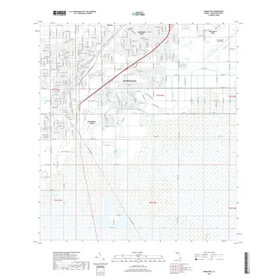
2018 Map of Homestead
USGS Topo · Published 2018About this map
Homestead and Florida City anchor this 2018 survey, reflecting the intensive residential and agricultural development of southern Miami-Dade County. The map captures a complex network of man-made waterways essential to the region's hydrology, including the Mowry Canal Number C-103, North Canal, and the Florida City Canal. To the northeast, the Homestead Air Reserve Base stands as a significant military installation, while institutional growth is evidenced by the Miami - Dade College Homestead Campus.
Find a feature on this map
22 named features on this map. Tap any name to fly to it.
Don’t see what you’re looking for? This feature index may not catch every label — zoom into the map to look around manually.
Map Details
Editions of this 2018 Homestead Map
This is the sole edition of this map. No revisions or reprints were ever made.
Other maps of this area

1949 · Card Sound
USGS Topo · 1:24,000

1949 · Arsenicker Keys
USGS Topo · 1:24,000

1949 · Goulds
USGS Topo · 1:24,000

1949 · Perrine
USGS Topo · 1:24,000

1950 · Homestead
USGS Topo · 1:24,000

1950 · Glades
USGS Topo · 1:24,000

1956 · Goulds
USGS Topo · 1:24,000

1956 · Card Sound
USGS Topo · 1:24,000

1956 · Perrine
USGS Topo · 1:24,000

1956 · Grossman Hammock
USGS Topo · 1:24,000