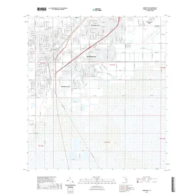
2021 Map of Homestead
USGS Topo · Published 2021About this map
Homestead and Florida City anchor this southern Florida landscape, where the dense street grids of the northern agricultural and residential hubs give way to an extensive network of drainage canals to the south. The map documents the intricate water management system essential to the region, featuring the North Canal, Florida City Canal, and the long, straight reach of the Model Land Canal cutting through the wetlands. This 2021 update shows the continued prominence of the Homestead Air Reserve Base on the eastern edge of the quadrangle, alongside institutional growth at the Miami-Dade College Homestead Campus. While the northern sections show concentrated development in Leisure City and Modello, the southern half remains a patterned expanse of wetlands and managed waterways, illustrating the sharp boundary between urban expansion and the preserved natural environment of the Everglades' doorstep.
Find a feature on this map
64 named features on this map. Tap any name to fly to it.
Don’t see what you’re looking for? This feature index may not catch every label — zoom into the map to look around manually.
Map Details
Editions of this 2021 Homestead Map
This is the sole edition of this map. No revisions or reprints were ever made.
Other maps of this area

1949 · Card Sound
USGS Topo · 1:24,000

1949 · Arsenicker Keys
USGS Topo · 1:24,000

1949 · Goulds
USGS Topo · 1:24,000

1949 · Perrine
USGS Topo · 1:24,000

1950 · Homestead
USGS Topo · 1:24,000

1950 · Glades
USGS Topo · 1:24,000

1956 · Goulds
USGS Topo · 1:24,000

1956 · Card Sound
USGS Topo · 1:24,000

1956 · Perrine
USGS Topo · 1:24,000

1956 · Grossman Hammock
USGS Topo · 1:24,000