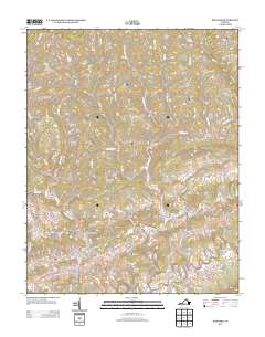
2013 Map of Honaker
USGS Topo · Published 2013About this map
Honaker serves as a primary hub in this corner of Russell County, situated near the headwaters and branches of the Clinch River. The map reveals a deeply etched landscape where settlements such as Putnam, Swords Creek, and Gardner are constrained to the narrow valleys and creek beds. This topography has historically dictated the path of regional development, with roads like New Garden Rd and Tigertown Dr threading between ridges. High ground like Fuller Mountain and Stone Mountain frame the residential pockets of Wysor Valley and Hollow Poplar Ridge. Genealogists may find value in tracing family-named landmarks such as Miller Hollow, Stilwell Hollow, and Robinson Ridge, which reflect the localized settlement patterns of Appalachia. The drainage network, including Lewis Cr and Little River, remains the defining feature of the area's geography, influencing everything from historic farm placement to modern infrastructure.
Find a feature on this map
127 named features on this map. Tap any name to fly to it.
Don’t see what you’re looking for? This feature index may not catch every label — zoom into the map to look around manually.
Map Details
Editions of this 2013 Honaker Map
This is the sole edition of this map. No revisions or reprints were ever made.
Other maps of this area

1886 · Grundy
USGS Topo · 1:125,000

1890 · Grundy
USGS Topo · 1:125,000

1891 · Tazewell
USGS Topo · 1:125,000

1891 · Abingdon
USGS Topo · 1:125,000

1892 · Grundy
USGS Topo · 1:125,000

1894 · Abingdon
USGS Topo · 1:125,000

1895 · Tazewell
USGS Topo · 1:125,000

1897 · Tazewell
USGS Topo · 1:125,000

1897 · Bristol
USGS Topo · 1:125,000

1902 · Bristol
USGS Topo · 1:125,000