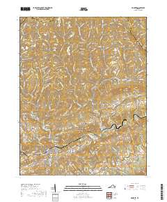
2019 Map of Honaker
USGS Topo · Published 2019About this map
Honaker and its surrounding valleys are defined by a complex network of ridges and river basins along the Buchanan and Russell county lines. The Norfolk Southern railroad follows the natural corridor of Wysor Valley through Hickory Junction and Putnam, highlighting the area's historical reliance on rail transport through the Appalachians. The landscape is densely packed with family-named landmarks and small burial sites, such as the Harvey-Honaker Cem and Robinette Cem, which provide a detailed genealogical record for the region. To the north, the Tennessee Valley Divide marks the transition of the watershed, while to the south, the Clinch River winds through the terrain near Gardner. Numerous hollows like Groundhog Hollow and Wolfpen Hollow score the mountainsides, illustrating the isolated settlement patterns that characterized these Southwest Virginia communities.
Find a feature on this map
162 named features on this map. Tap any name to fly to it.
Don’t see what you’re looking for? This feature index may not catch every label — zoom into the map to look around manually.
Map Details
Editions of this 2019 Honaker Map
This is the sole edition of this map. No revisions or reprints were ever made.
Other maps of this area

1886 · Grundy
USGS Topo · 1:125,000

1890 · Grundy
USGS Topo · 1:125,000

1891 · Tazewell
USGS Topo · 1:125,000

1891 · Abingdon
USGS Topo · 1:125,000

1892 · Grundy
USGS Topo · 1:125,000

1894 · Abingdon
USGS Topo · 1:125,000

1895 · Tazewell
USGS Topo · 1:125,000

1897 · Tazewell
USGS Topo · 1:125,000

1897 · Bristol
USGS Topo · 1:125,000

1902 · Bristol
USGS Topo · 1:125,000