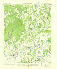
1935 Map of Honaker
USGS Topo · Published 1935About this map
Honaker serves as a primary hub in southwestern Virginia during the mid-1930s, anchored by the Norfolk and Western RR as it tracks through the Clinch River valley. This survey reveals a landscape deeply organized around its ridges and hollows, where local life centered on a dense network of country schools such as Hess Creek Sch and Hortons Ridge Sch. Industrial footprints are visible in the Appalachian Electric Power Co Trans Line and scattered settlements like Candlewax and Punkett Center. The relationship between the rugged terrain and transportation is evident where State Highway No 80 and State Highway No 83 navigate the gaps between Stone Mountain and Poplar Ridge. Smaller rural operations like Gardner Mill and the Gardner Gardners P O reflect the era's localized economy before broader regional consolidation.
Find a feature on this map
79 named features on this map. Tap any name to fly to it.
Don’t see what you’re looking for? This feature index may not catch every label — zoom into the map to look around manually.
Map Details
Editions of this 1935 Honaker Map
This is the sole edition of this map. No revisions or reprints were ever made.
Other maps of this area

1886 · Grundy
USGS Topo · 1:125,000

1890 · Grundy
USGS Topo · 1:125,000

1891 · Tazewell
USGS Topo · 1:125,000

1891 · Abingdon
USGS Topo · 1:125,000

1892 · Grundy
USGS Topo · 1:125,000

1894 · Abingdon
USGS Topo · 1:125,000

1895 · Tazewell
USGS Topo · 1:125,000

1897 · Tazewell
USGS Topo · 1:125,000

1897 · Bristol
USGS Topo · 1:125,000

1902 · Bristol
USGS Topo · 1:125,000