2021 Map of Honcut
USGS Topo · Published 2021About this map
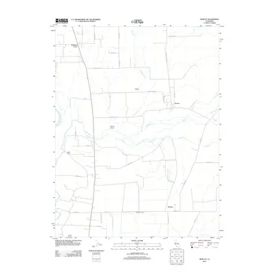
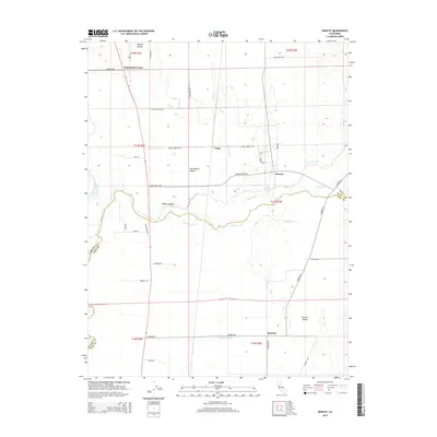
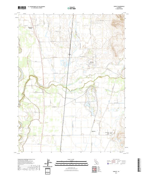
Honcut Creek defines the local landscape as it winds through the Sacramento Valley, serving as the border between Butte and Yuba counties. This agricultural region is marked by a complex network of waterways, including Wyman Ravine, Wyandotte Creek, and Simmerly Slough, which drain into the main channel near the Feather River corridor. The map reveals a rural settlement pattern anchored by small hubs like Honcut, Craig, and Robinsons Corner, connected by a grid of named local roads such as Central House Road and Palermo Honcut Highway. The presence of a prominent Levee in the southwest highlights the ongoing management of the valley's floodplains. Researchers can trace the division of ranch and farm lands across townships like t17n r4e, where the legacy of early California land use remains visible in the current road and property boundaries.
Find a feature on this map
52 named features on this map. Tap any name to fly to it.
Don’t see what you’re looking for? This feature index may not catch every label — zoom into the map to look around manually.
Map Details
Editions of this 2021 Honcut Map
This is the sole edition of this map. No revisions or reprints were ever made.
Historical Maps of Robinsons Corner Through Time
6 maps found