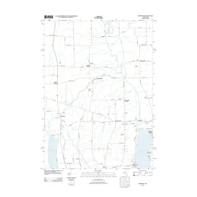
2013 Map of Honeoye
USGS Topo · Published 2013About this map
Hemlock Lake and Honeoye Lake anchor this western New York landscape, which is defined by a dense network of watercourses including the Canadice Outlet, Hemlock Outlet, and Whetstone Brook. The 2013 survey shows a region largely preserved in its rural character, marked by small settlements like Honeoye, Hemlock, and Richmond Center. Genealogists and local historians will find significant value in the numerous burial grounds documented here, such as Richmond Center Cem, Purcell Cem, and the Canadice Hollow Cem. The terrain is punctuated by distinctive geographic features like Abbey Gulf and Bray Gully along the eastern shore of Honeoye Lake. Transportation and utility infrastructure are represented by local landmarks like the Old Fort Farm Airport and Coye Field Airport, as well as the naming of small corners and farmstead clusters like Denison Corner and Bosley Corner.
Find a feature on this map
98 named features on this map. Tap any name to fly to it.
Don’t see what you’re looking for? This feature index may not catch every label — zoom into the map to look around manually.
Map Details
Editions of this 2013 Honeoye Map
This is the sole edition of this map. No revisions or reprints were ever made.
Other maps of this area

1900 · Naples
USGS Topo · 1:62,500

1900 · Canandaigua
USGS Topo · 1:62,500

1901 · Honeoye
USGS Topo · 1:62,500

1902 · Wayland
USGS Topo · 1:62,500

1903 · Naples
USGS Topo · 1:62,500

1903 · Canandaigua
USGS Topo · 1:62,500

1904 · Wayland
USGS Topo · 1:62,500

1904 · Honeoye
USGS Topo · 1:62,500

1913 · Naples
USGS Topo · 1:62,500

1934 · Rush
USGS Topo · 1:24,000