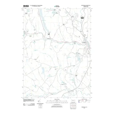
2010 Map of Honesdale
USGS Topo · Published 2010About this map
Honesdale and the surrounding boroughs in Wayne County are depicted here in detail, showcasing a landscape defined by the Lackawaxen River and an extensive network of water control features. The map illustrates a historical transition from industrial river use to modern flood management, evidenced by the Woolen Mill Dam and the massive General Edgar Jadwin Dam. To the west, the borough of Bethany and the village of Prompton sit amidst a complex of smaller water bodies such as Glass Pond Number One and Glass Pond Number Two. For genealogists and local historians, several burial grounds are carefully marked, including the Glass Factory Cemetery, Schoonover Cemetery, and Keen Cemetery. The presence of the Cavage Airport and the Elk Forest Resort Golf Course alongside older naming conventions like the Owego Tpke and Old Railroad reflects the area's gradual development into a recreational and residential hub north of the coal regions.
Find a feature on this map
113 named features on this map. Tap any name to fly to it.
Don’t see what you’re looking for? This feature index may not catch every label — zoom into the map to look around manually.
Map Details
Editions of this 2010 Honesdale Map
This is the sole edition of this map. No revisions or reprints were ever made.
Other maps of this area

1892 · Honesdale
USGS Topo · 1:62,500

1920 · Damascus
USGS Topo · 1:62,500

1923 · Damascus
USGS Topo · 1:62,500

1928 · Ariel
USGS Topo · 1:62,500

1932 · Ariel
USGS Topo · 1:62,500

1935 · Hawley
USGS Topo · 1:62,500

1938 · Hawley
USGS Topo · 1:62,500

1943 · Honesdale
USGS Topo · 1:125,000

1944 · Damascus
USGS Topo · 1:62,500

1946 · Forest City
USGS Topo · 1:24,000