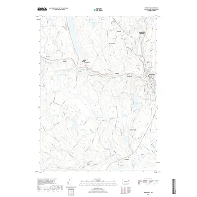
2019 Map of Honesdale
USGS Topo · Published 2019About this map
Honesdale and the surrounding plateau of Wayne County are defined by a complex network of waterways, where the Lackawaxen River meets its West Branch. The borough of Honesdale serves as a clear civic center, anchored by the Wayne County Courthouse and a dense street grid that includes landmarks such as the Saint Mary Magdalen Cem. Surrounding the town, smaller settlements like Seelyville, Cherry Ridge, and Bethany are connected by historical turnpikes and rural routes, reflecting a landscape long shaped by small-scale agriculture and early industry.
Find a feature on this map
140 named features on this map. Tap any name to fly to it.
Don’t see what you’re looking for? This feature index may not catch every label — zoom into the map to look around manually.
Map Details
Editions of this 2019 Honesdale Map
This is the sole edition of this map. No revisions or reprints were ever made.
Other maps of this area

1892 · Honesdale
USGS Topo · 1:62,500

1920 · Damascus
USGS Topo · 1:62,500

1923 · Damascus
USGS Topo · 1:62,500

1928 · Ariel
USGS Topo · 1:62,500

1932 · Ariel
USGS Topo · 1:62,500

1935 · Hawley
USGS Topo · 1:62,500

1938 · Hawley
USGS Topo · 1:62,500

1943 · Honesdale
USGS Topo · 1:125,000

1944 · Damascus
USGS Topo · 1:62,500

1946 · Forest City
USGS Topo · 1:24,000