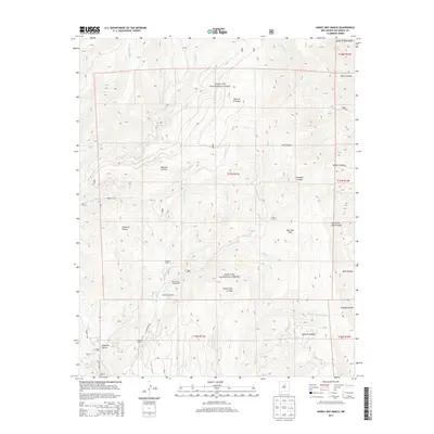
2013 Map of Honey Boy Ranch
USGS Topo · Published 2013About this map
Honey Boy Ranch and Emerson Ranch anchor the high-country landscape of the Santa Fe National Forest in this early 21st-century study of San Miguel County. The terrain is defined by a dense network of high-elevation valleys and drainages, including the Valle de la Piedra, Valle de la Osha, and Valle del Toro. Waterways like Gallinas Cr and Rito Manzanares flow through these meadows, tracing the natural contours of the Santa Fe Mountains. Recreational and remote living is evident at Manzanares Campground and the Manzanares Cabin, while narrow forest corridors like Forest 86A Rd provide the only access through steep features like Cañon de Tijeras. This map documents a quiet, sparsely populated corner of New Mexico where land use is split between ranching, forestry, and mountain preservation.
Find a feature on this map
40 named features on this map. Tap any name to fly to it.
Don’t see what you’re looking for? This feature index may not catch every label — zoom into the map to look around manually.
Map Details
Editions of this 2013 Honey Boy Ranch Map
This is the sole edition of this map. No revisions or reprints were ever made.
Other maps of this area

1889 · Las Vegas
USGS Topo · 1:125,000

1889 · Santa Fe
USGS Topo · 1:125,000

1891 · Las Vegas
USGS Topo · 1:125,000

1893 · Las Vegas
USGS Topo · 1:125,000

1894 · Santa Fe
USGS Topo · 1:125,000

1954 · Santa Fe
USGS Topo · 1:250,000

1958 · Santa Fe
USGS Topo · 1:250,000

1961 · San Geronimo
USGS Topo · 1:24,000

1961 · El Porvenir
USGS Topo · 1:24,000

1961 · Honey Boy Ranch
USGS Topo · 1:24,000