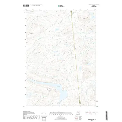
2019 Map of Honnedaga Lake
USGS Topo · Published 2019About this map
Honnedaga Lake and its high-elevation surrounding basins dominate this 2019 survey of the Adirondack wilderness along the Herkimer Co and Hamilton Co line. This landscape is defined by its complex hydrography, where the headwaters of major drainage systems originate within short distances of one another. To the west, the N Br Black River and Middle Br Black River flow toward the Black River valley, while West Canada Creek and its tributaries like Jones Brook carve paths to the south.
Find a feature on this map
33 named features on this map. Tap any name to fly to it.
Don’t see what you’re looking for? This feature index may not catch every label — zoom into the map to look around manually.
Map Details
Editions of this 2019 Honnedaga Lake Map
This is the sole edition of this map. No revisions or reprints were ever made.
Other maps of this area

1900 · Canada Lake
USGS Topo · 1:62,500

1900 · Wilmurt
USGS Topo · 1:62,500

1901 · Old Forge
USGS Topo · 1:62,500

1902 · Wilmurt
USGS Topo · 1:62,500

1903 · West Canada Lakes
USGS Topo · 1:62,500

1904 · Piseco Lake
USGS Topo · 1:62,500

1906 · Piseco Lake
USGS Topo · 1:62,500

1908 · Piseco Lake
USGS Topo · 1:62,500

1950 · Utica
USGS Topo · 1:250,000
1954 · Ohio
USGS Topo · 1:62,500