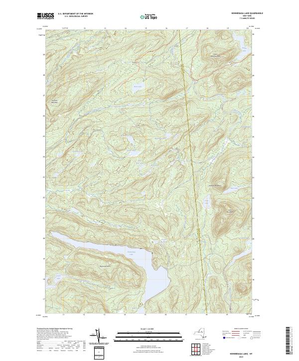
2023 Map of Honnedaga Lake
USGS Topo · Published 2023About this map
Honnedaga Lake and its surrounding watershed dominate this portion of the Adirondacks, situated along the Herkimer and Hamilton county line. The landscape is defined by an intricate network of alpine lakes and streams, including South Lake, Indian Lake, and the North Branch Black River. Steep peaks such as Panther Mountain and Ice-Cave Mountain tower over unique terrain features like Stearns Mudhole and Carter Mudhole.
Find a feature on this map
32 named features on this map. Tap any name to fly to it.
Don’t see what you’re looking for? This feature index may not catch every label — zoom into the map to look around manually.
Map Details
Editions of this 2023 Honnedaga Lake Map
This is the sole edition of this map. No revisions or reprints were ever made.
Other maps of this area

1900 · Canada Lake
USGS Topo · 1:62,500

1900 · Wilmurt
USGS Topo · 1:62,500

1901 · Old Forge
USGS Topo · 1:62,500

1902 · Wilmurt
USGS Topo · 1:62,500

1903 · West Canada Lakes
USGS Topo · 1:62,500

1904 · Piseco Lake
USGS Topo · 1:62,500

1906 · Piseco Lake
USGS Topo · 1:62,500

1908 · Piseco Lake
USGS Topo · 1:62,500

1950 · Utica
USGS Topo · 1:250,000
1954 · Ohio
USGS Topo · 1:62,500