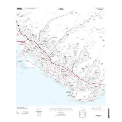
2013 Map of Honolulu
USGS Topo · Published 2013About this map
Diamond Head anchors the southeastern coastline of this dense urban and natural landscape, overlooking a corridor of development that includes Waikiki and Kaneloa. The map reveals the intricate residential layering of the city, from the historical streets of Chinatown and the Palama Settlement to the elevated neighborhoods of Saint Louis Heights and 'Alewa Heights. In the valleys and along the steep ridges of the Ko'olau Range, the transition from urban density to conservation is sharp, marked by the Lyon Arboretum and the watershed surrounding Nu'uanu Reservoir Number Four.
Find a feature on this map
130 named features on this map. Tap any name to fly to it.
Don’t see what you’re looking for? This feature index may not catch every label — zoom into the map to look around manually.
Map Details
Editions of this 2013 Honolulu Map
This is the sole edition of this map. No revisions or reprints were ever made.
Other maps of this area

1952 · Koko Head
USGS Topo · 1:24,000

1952 · Mokapu
USGS Topo · 1:24,000

1953 · Honolulu
USGS Topo · 1:24,000

1953 · Puuloa
USGS Topo · 1:24,000

1954 · Oahu
USGS Topo · 1:250,000

1954 · Kaneohe
USGS Topo · 1:24,000

1954 · Waipahu
USGS Topo · 1:24,000

1959 · Mokapu
USGS Topo · 1:24,000

1959 · Koko Head
USGS Topo · 1:24,000

1959 · Kaneohe
USGS Topo · 1:24,000