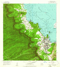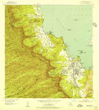
1954 Map of Kaneohe
USGS Topo · Published 1956About this map
The windward coast of Oahu is defined here by the steep, fluted ridges of the Koolau Range, where the forest reserves of Waikane, Waiahole, and Waihee give way to the burgeoning mid-century developments of Kaneohe. Along the shore of Kaneohe Bay, land use is a mix of traditional Hawaiian aquaculture and modern infrastructure, evidenced by the proximity of Heeia Pond to the Heeia Radio Station. Significant agricultural history is preserved in the naming of the Waiahole, Waikalua, and Halekou Waikaluakai Homesteads tracts, which mark the era's transition from plantation-style labor to individual family holdings.
Find a feature on this map
81 named features on this map. Tap any name to fly to it.
Don’t see what you’re looking for? This feature index may not catch every label — zoom into the map to look around manually.
Map Details
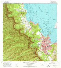
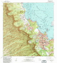
Editions of this 1954 Kaneohe Map
This is the sole edition of this map. No revisions or reprints were ever made.
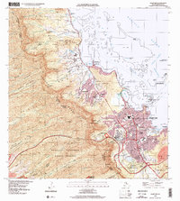
Historical Maps of Honolulu Through Time
8 maps found