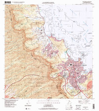
1998 Map of Kaneohe
USGS Topo · Published 2000About this map
The Ko‘olau Range forms a dramatic backdrop for the windward coast of Oahu, where dense residential development in Kaneohe transitions into the agriculture-rich Waiahole Homesteads and Kailua-Poai Waikalua Homesteads. This late-twentieth-century landscape is defined by its careful management of water and sacred spaces, featuring the landmark Byodo-In Temple within the Valley of the Temples Cem. Coastal life is anchored by traditional water features like He‘eia Pond and the expansive Kaneohe Bay, while inland, the Honolulu Watershed Forest Reserve protects the high ridges. Significant infrastructure is present, including the U S Coast Guard Omega Station and the sprawling Ho‘omaluhia Botanical Garden, illustrating the balance between military presence, preservation, and suburban growth near Pu‘ohala Village.
Find a feature on this map
76 named features on this map. Tap any name to fly to it.
Don’t see what you’re looking for? This feature index may not catch every label — zoom into the map to look around manually.
Map Details
Editions of this 1998 Kaneohe Map
This is the sole edition of this map. No revisions or reprints were ever made.
Other maps of this area

1952 · Koko Head
USGS Topo · 1:24,000

1952 · Mokapu
USGS Topo · 1:24,000

1953 · Honolulu
USGS Topo · 1:24,000

1953 · Puuloa
USGS Topo · 1:24,000

1953 · Hauula
USGS Topo · 1:24,000

1954 · Oahu
USGS Topo · 1:250,000

1954 · Kahana
USGS Topo · 1:24,000

1954 · Kaneohe
USGS Topo · 1:24,000

1954 · Waipahu
USGS Topo · 1:24,000

1959 · Mokapu
USGS Topo · 1:24,000