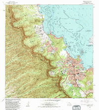
1983 Map of Kaneohe
USGS Topo · Published 1983About this map
The Koolau Range dominates the western half of this 1983 survey, where sharp ridges like Puu Keahiakahoe descend toward the windward coast of Oahu. This era shows the developed suburban character of Kaneohe and Ahuimanu juxtaposed with traditional landscape features. Significant land use is visible at the Valley of the Temples (Cem), featuring the Byodo-In Temple, and the expansive Hoomaluhia Park near the foot of the mountains. Along the shoreline, ancient Hawaiian engineering remains evident in the Kahaluu Pond and Heeia Pond, while the eastern edge is defined by the Kaneohe Bay Marine Corps Air Station. The map captures a transition from the agricultural heritage of the Waiahole Homesteads to modern educational and institutional hubs like Windward Community College and the University of Hawaii Marine Laboratory on Moku o Loe.
Find a feature on this map
82 named features on this map. Tap any name to fly to it.
Don’t see what you’re looking for? This feature index may not catch every label — zoom into the map to look around manually.
Map Details
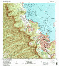
Editions of this 1983 Kaneohe Map
2 editions found
Other maps of this area

1952 · Koko Head
USGS Topo · 1:24,000

1952 · Mokapu
USGS Topo · 1:24,000

1953 · Honolulu
USGS Topo · 1:24,000

1953 · Puuloa
USGS Topo · 1:24,000

1953 · Hauula
USGS Topo · 1:24,000

1954 · Oahu
USGS Topo · 1:250,000

1954 · Kahana
USGS Topo · 1:24,000

1954 · Kaneohe
USGS Topo · 1:24,000

1954 · Waipahu
USGS Topo · 1:24,000

1959 · Mokapu
USGS Topo · 1:24,000