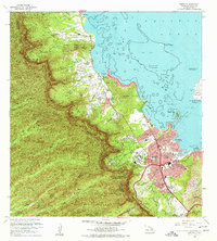
1968 Map of Kaneohe
USGS Topo · Published 1977About this map
Kaneohe and the windward coast of Oahu are depicted here during a period of significant mid-century development, where traditional agricultural homesteads meet expanding suburban infrastructure. The residential clusters of Puohala Village and various homestead tracts, such as the Halekou Waikaluakai Homesteads, show the densification of the landscape near the shoreline of Kaneohe Bay. Notable cultural and institutional landmarks include the Byodo-In Temple within the Valley of the Temples Cem, the expansive State Hospital grounds, and the University of Hawaii Marine Laboratory situated on Moku o Loe. The transition from the coastal plains to the steep interior is marked by the Honolulu Watershed Forest Reserve and the Waikane-Waiahole Ditch Trail, reflecting the critical importance of water management in this environment. The presence of the Kaneohe Marine Corps Air Station and the Haiku Radio Station Reservation underscore the strategic military footprint on the island during this era.
Find a feature on this map
73 named features on this map. Tap any name to fly to it.
Don’t see what you’re looking for? This feature index may not catch every label — zoom into the map to look around manually.
Map Details
Editions of this 1968 Kaneohe Map
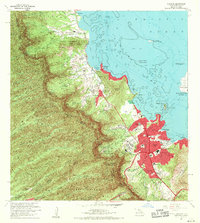
2 editions found
Other maps of this area

1952 · Koko Head
USGS Topo · 1:24,000

1952 · Mokapu
USGS Topo · 1:24,000

1953 · Honolulu
USGS Topo · 1:24,000

1953 · Puuloa
USGS Topo · 1:24,000

1953 · Hauula
USGS Topo · 1:24,000

1954 · Oahu
USGS Topo · 1:250,000

1954 · Kahana
USGS Topo · 1:24,000

1954 · Kaneohe
USGS Topo · 1:24,000

1954 · Waipahu
USGS Topo · 1:24,000

1959 · Mokapu
USGS Topo · 1:24,000