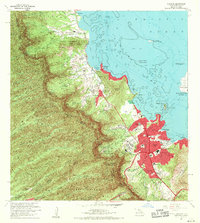
1968 Map of Kaneohe
USGS Topo · Published 1970About this map
Koolau Range peaks like Eleao and Puu Keahiakahoe form a dramatic backdrop for the windward communities of Oahu during the late 1960s. The landscape transitions from the dense Honolulu Watershed Forest Reserve down to the complex coastline of Kaneohe Bay, where extensive coral reefs and ancient structures like Heeia Pond and Kahaluu Pond remain visible. This period shows significant suburban and institutional development, including the State Hospital, Byodo-In Temple, and the sprawling Hawaiian Memorial Park (Cem). Local agriculture and residential patterns are preserved in the various land divisions such as Waiahole Homesteads and Halekou Waikaluakai Homesteads. On the water, a Cable Ferry serves Moku o Loe, home to the University of Hawaii Marine Laboratory, while the Kaneohe Marine Corps Air Station occupies the eastern peninsula.
Find a feature on this map
79 named features on this map. Tap any name to fly to it.
Don’t see what you’re looking for? This feature index may not catch every label — zoom into the map to look around manually.
Map Details
Editions of this 1968 Kaneohe Map
2 editions found
Other maps of this area

1952 · Koko Head
USGS Topo · 1:24,000

1952 · Mokapu
USGS Topo · 1:24,000

1953 · Honolulu
USGS Topo · 1:24,000

1953 · Puuloa
USGS Topo · 1:24,000

1953 · Hauula
USGS Topo · 1:24,000

1954 · Oahu
USGS Topo · 1:250,000

1954 · Kahana
USGS Topo · 1:24,000

1954 · Kaneohe
USGS Topo · 1:24,000

1954 · Waipahu
USGS Topo · 1:24,000

1959 · Mokapu
USGS Topo · 1:24,000