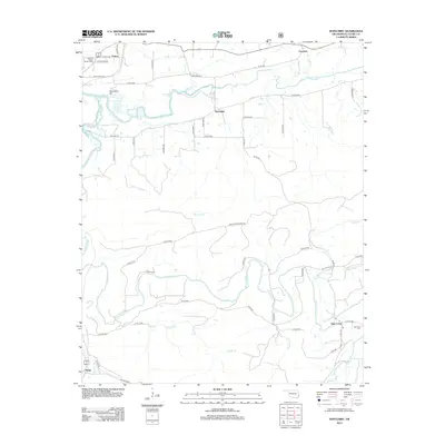
2013 Map of Hontubby
USGS Topo · Published 2013About this map
The Poteau River and Black Fork define the drainage of this Oklahoma landscape, where the Hontubby Falls sit just west of the small settlement of Hontubby. In the northern section, the Choctaw District Ranger Office is located near Petros, while the southern reaches of the map show the community of Stapp near the banks of McMurtery Br. The presence of the Big Creek Cem near Haw Creek provides a focal point for genealogical research in this rural portion of Le Flore County. Much of the area is crisscrossed by forest service roads and county routes such as Hontubby Rd and Old US Hwy 59, reflecting a landscape tied to both forestry management and local agriculture along the river bottoms and creek beds like Oil Br and Frizzell Br.
Find a feature on this map
51 named features on this map. Tap any name to fly to it.
Don’t see what you’re looking for? This feature index may not catch every label — zoom into the map to look around manually.
Map Details
Editions of this 2013 Hontubby Map
This is the sole edition of this map. No revisions or reprints were ever made.
Other maps of this area

1887 · Poteau Mountain #2
USGS Topo · 1:62,500

1890 · Poteau Mountain
USGS Topo · 1:125,000

1899 · Poteau Mountain
USGS Topo · 1:125,000

1900 · Winding Stair
USGS Topo · 1:125,000

1909 · Winding Stair
USGS Topo · 1:125,000

1950 · Mcalester
USGS Topo · 1:250,000
1958 · Loving
USGS Topo · 1:24,000
1958 · Bates
USGS Topo · 1:62,500

1958 · Potter
USGS Topo · 1:62,500
1958 · Bates
USGS Topo · 1:24,000