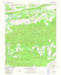
1981 Map of Hontubby
USGS Topo · Published 1981About this map
The Poteau River winds through the northern valley of this landscape, flanked by the residential blocks of Heavener and the industrial infrastructure of the Kansas City Southern railroad. The terrain is dominated by the ridges of Walker Mountain and Heavener Ridge, where the dense canopy of the Ouachita National Forest covers much of the southern and central sections. Small rural settlements and family landmarks are scattered throughout the lowlands, including the community of Hontubby and the site of Hontubby Falls.
Find a feature on this map
33 named features on this map. Tap any name to fly to it.
Don’t see what you’re looking for? This feature index may not catch every label — zoom into the map to look around manually.
Map Details
Editions of this 1981 Hontubby Map
This is the sole edition of this map. No revisions or reprints were ever made.
Other maps of this area

1887 · Poteau Mountain #2
USGS Topo · 1:62,500

1890 · Poteau Mountain
USGS Topo · 1:125,000

1899 · Poteau Mountain
USGS Topo · 1:125,000

1900 · Winding Stair
USGS Topo · 1:125,000

1909 · Winding Stair
USGS Topo · 1:125,000

1950 · Mcalester
USGS Topo · 1:250,000
1958 · Loving
USGS Topo · 1:24,000
1958 · Bates
USGS Topo · 1:62,500

1958 · Potter
USGS Topo · 1:62,500
1958 · Bates
USGS Topo · 1:24,000