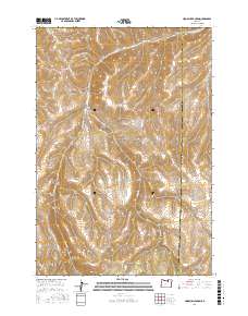
2017 Map of Hoodlum Canyon
USGS Topo · Published 2017About this map
Butter Cr carves a central path through this high-desert landscape on the border of Morrow and Umatilla Counties. The area is defined by a series of deep, branching drainages that feed into the creek, including Hoodlum Canyon, Frisco Canyon, and Cunha Canyon. These landforms suggest a topography shaped by seasonal runoff and long-term erosion, creating natural corridors through the plateau.
Find a feature on this map
20 named features on this map. Tap any name to fly to it.
Don’t see what you’re looking for? This feature index may not catch every label — zoom into the map to look around manually.
Map Details
Editions of this 2017 Hoodlum Canyon Map
This is the sole edition of this map. No revisions or reprints were ever made.
Other maps of this area

1953 · Pendleton
USGS Topo · 1:250,000

1956 · Pendleton
USGS Topo · 1:250,000

1967 · Freezeout Ridge
USGS Topo · 1:24,000

1968 · Hoodlum Canyon
USGS Topo · 1:24,000

1968 · Lena
USGS Topo · 1:24,000

1968 · Gurdane
USGS Topo · 1:24,000
1968 · Vinson
USGS Topo · 1:24,000
1968 · Franklin Hill
USGS Topo · 1:24,000

1969 · Sugarbowl Creek
USGS Topo · 1:24,000

1969 · Arbuckle Mtn
USGS Topo · 1:24,000