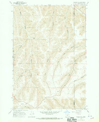
1968 Map of Franklin Hill
USGS Topo · Published 1970About this map
Franklin Hill rises as a prominent landmark in this high-desert landscape of eastern Oregon during the late 1960s. The topography is defined by a dense network of drainage systems, including the deeply etched Matlock Canyon, Cunningham Canyon, and Dixie Canyon, all of which contribute to the larger watershed of Butter Creek in the northeast. The presence of a Gravel Pit and numerous mapped springs indicates the localized importance of resource extraction and water management in this arid environment. The map clearly delineates the zigzagging county line separating Morrow County and Umatilla County, following the ridge lines and natural contours. This detailed surveying reveals a quiet, working landscape where topographical names like Hog Hollow and Nelson Canyon reflect the heritage of local land use and ranching history in the region.
Find a feature on this map
15 named features on this map. Tap any name to fly to it.
Don’t see what you’re looking for? This feature index may not catch every label — zoom into the map to look around manually.
Map Details
Editions of this 1968 Franklin Hill Map
This is the sole edition of this map. No revisions or reprints were ever made.
Other maps of this area

1908 · Umatilla
USGS Topo · 1:125,000

1953 · Pendleton
USGS Topo · 1:250,000

1956 · Pendleton
USGS Topo · 1:250,000

1967 · Freezeout Ridge
USGS Topo · 1:24,000

1968 · Hoodlum Canyon
USGS Topo · 1:24,000
1968 · Echo SE
USGS Topo · 1:24,000

1968 · Lena
USGS Topo · 1:24,000

1968 · Vey Ranch
USGS Topo · 1:24,000

1968 · Gurdane
USGS Topo · 1:24,000
1968 · Vinson
USGS Topo · 1:24,000