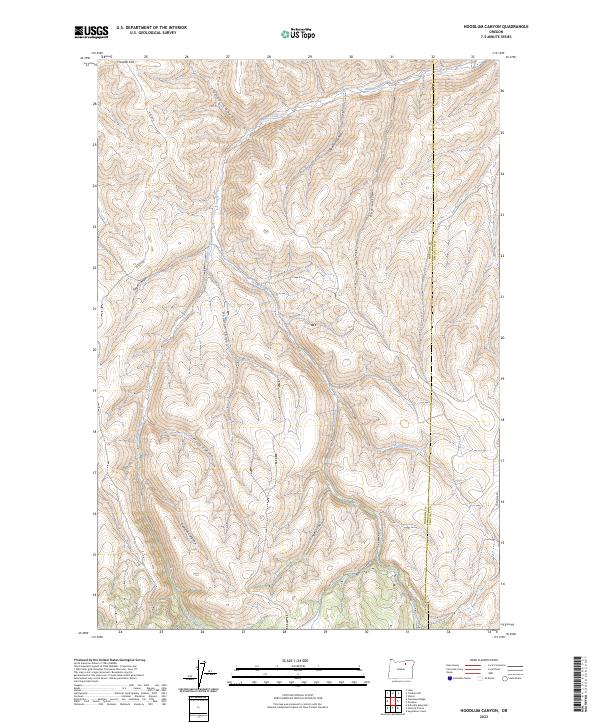
2023 Map of Hoodlum Canyon
USGS Topo · Published 2023About this map
Butter Creek flows through this corner of Eastern Oregon, carving a network of drainages across the Morrow and Umatilla county line. The terrain is defined by its deep canyons and named gulches, including Hoodlum Canyon, Frisco Canyon, and Cunha Canyon. These features demonstrate the erosional patterns typical of the region, where watercourses like Johnson Creek and Gurdane Creek have shaped the high-elevation landscape. Transportation in the area is limited to rural routes such as Hisler Rd and Gurdane Rd, which follow the natural contours of the hills. Rising above the valleys, Franklin Hill provides a distinct landmark near the northern boundary. The grid system visible on the sheet, marking townships like t3s r29e, illustrates the enduring structure of the Public Land Survey System in this sparsely populated portion of the state.
Find a feature on this map
22 named features on this map. Tap any name to fly to it.
Don’t see what you’re looking for? This feature index may not catch every label — zoom into the map to look around manually.
Map Details
Editions of this 2023 Hoodlum Canyon Map
This is the sole edition of this map. No revisions or reprints were ever made.
Other maps of this area

1953 · Pendleton
USGS Topo · 1:250,000

1956 · Pendleton
USGS Topo · 1:250,000

1967 · Freezeout Ridge
USGS Topo · 1:24,000

1968 · Hoodlum Canyon
USGS Topo · 1:24,000

1968 · Lena
USGS Topo · 1:24,000

1968 · Gurdane
USGS Topo · 1:24,000
1968 · Vinson
USGS Topo · 1:24,000
1968 · Franklin Hill
USGS Topo · 1:24,000

1969 · Sugarbowl Creek
USGS Topo · 1:24,000

1969 · Arbuckle Mtn
USGS Topo · 1:24,000