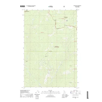
2020 Map of Hoodoo Pass
USGS Topo · Published 2020About this map
Bancroft, Goffs, and Netawaka anchor this agricultural landscape in Nemaha and Jackson Counties, where the Missouri Pacific Railroad (M. P. R. R.) cuts a decisive path through the undulating terrain. Small rural communities like Whiting and Kelly serve as focal points for the surrounding farmsteads. The region's social fabric is evidenced by numerous educational and commemorative sites, including Pleasant Hill School, Pleasant Grove School, and Sunny Side School, along with the McCarty Cemetery and Shinn Cemetery. Waterways such as the Little Blue River, Straight Creek, and Muddy Creek define the local topography, carving paths through the plains. The map reveals a network of section lines and early roads connecting these townships, illustrating the organized expansion of settlement and the reliance on local resources and rail transport for growth in this Kansas prairie region.
Find a feature on this map
44 named features on this map. Tap any name to fly to it.
Don’t see what you’re looking for? This feature index may not catch every label — zoom into the map to look around manually.
Map Details
Editions of this 2020 Hoodoo Pass Map
This is the sole edition of this map. No revisions or reprints were ever made.
Other maps of this area

1911 · Lolo
USGS Topo · 1:250,000

1913 · Lolo
USGS Topo · 1:250,000

1918 · St Regis
USGS Topo · 1:125,000

1919 · St. Regis
USGS Topo · 1:125,000

1956 · Wallace
USGS Topo · 1:250,000

1956 · Hamilton
USGS Topo · 1:250,000

1957 · Illinois Peak
USGS Topo · 1:62,500

1959 · Hamilton
USGS Topo · 1:250,000

1960 · Wallace
USGS Topo · 1:250,000

1960 · Hamilton
USGS Topo · 1:250,000