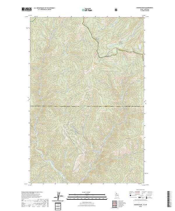
2024 Map of Hoodoo Pass
USGS Topo · Published 2024About this map
Hoodoo Pass sits at the high-elevation divide where the Bitterroot Range splits the border of Idaho and Montana. This survey documents the intersection of the Lolo National Forest and the Clearwater National Forest, a landscape defined by the drainage basins of the North Fork Clearwater River and its numerous tributaries like Long Creek and Slate Creek. The map details a network of high-country routes, including the Stateline Trl and Hoodoo Lake Access Trl, which connect the meadows and alpine waters of the interior to more established paths. Local geography is marked by prominent crests such as Long Creek Ridge and Goose Ridge, alongside named overlooks like Trap Point and Short Point that overlook the deeply carved river valleys of Shoshone and Clearwater Counties.
Find a feature on this map
42 named features on this map. Tap any name to fly to it.
Don’t see what you’re looking for? This feature index may not catch every label — zoom into the map to look around manually.
Map Details
Editions of this 2024 Hoodoo Pass Map
This is the sole edition of this map. No revisions or reprints were ever made.
Other maps of this area

1911 · Lolo
USGS Topo · 1:250,000

1913 · Lolo
USGS Topo · 1:250,000

1918 · St Regis
USGS Topo · 1:125,000

1919 · St. Regis
USGS Topo · 1:125,000

1956 · Wallace
USGS Topo · 1:250,000

1956 · Hamilton
USGS Topo · 1:250,000

1957 · Illinois Peak
USGS Topo · 1:62,500

1959 · Hamilton
USGS Topo · 1:250,000

1960 · Wallace
USGS Topo · 1:250,000

1960 · Hamilton
USGS Topo · 1:250,000