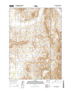
2014 Map of Hooker Creek
USGS Topo · Published 2014About this map
The high desert borderlands of Oregon and Idaho define this 2014 survey, where livestock management and water access dictate the landscape. Situated in Malheur County, the terrain is shaped by a network of ranching infrastructure including the Last Change Reservoir, Stearns Reservoir, and Hooker Reservoir. The drainage of Hooker Creek and Cow Cr moves through a series of ridges and basins, with Spring Mtn and Purser Ridge serving as prominent landmarks. Transportation across this arid plateau relies on corridors like the Ion Hwy and the Silver City Cutoff Rd, which follow ancient pathways through the sagebrush. Named water sources such as Poacher Spring and Bennett Spring highlight the critical nature of reliable water in this remote corner of the Owyhee country.
Find a feature on this map
42 named features on this map. Tap any name to fly to it.
Don’t see what you’re looking for? This feature index may not catch every label — zoom into the map to look around manually.
Map Details
Editions of this 2014 Hooker Creek Map
This is the sole edition of this map. No revisions or reprints were ever made.
Other maps of this area

1892 · Silver City
USGS Topo · 1:125,000

1894 · Silver City
USGS Topo · 1:125,000

1898 · Silver City
USGS Topo · 1:125,000

1955 · Jordan Valley
USGS Topo · 1:250,000

1955 · Boise
USGS Topo · 1:250,000

1957 · Jordan Valley
USGS Topo · 1:250,000

1958 · Boise
USGS Topo · 1:250,000

1958 · Jordan Valley
USGS Topo · 1:250,000

1962 · Boise
USGS Topo · 1:250,000

1965 · Rooster Comb Peak
USGS Topo · 1:62,500