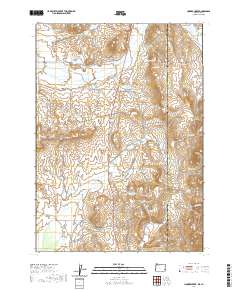
2020 Map of Hooker Creek
USGS Topo · Published 2020About this map
The high desert landscape along the Oregon and Idaho border centers on an intricate network of water management features and cattle-ranching infrastructure. Prominent water catchments like Hooker Reservoir, Chevally Reservoir, and Stearns Reservoir are vital landmarks in this arid terrain, connected by seasonal drainages such as Cow Cr and Hooker Cr. The state line, separating Malheur Co, Oregon, from Owyhee Co, Idaho, runs north to south through the eastern portion of the map, intersecting Purser Ridge and Spring Br. Transport through the region is defined by remote thoroughfares like the Silver City Cutoff and Curly Lodge Rd, reflecting the area's history of livestock grazing and passage to nearby mining districts. Landforms such as Big Ridge and Spring Mtn provide significant vertical relief against the system of flats and reservoirs.
Find a feature on this map
43 named features on this map. Tap any name to fly to it.
Don’t see what you’re looking for? This feature index may not catch every label — zoom into the map to look around manually.
Map Details
Editions of this 2020 Hooker Creek Map
This is the sole edition of this map. No revisions or reprints were ever made.
Other maps of this area

1892 · Silver City
USGS Topo · 1:125,000

1894 · Silver City
USGS Topo · 1:125,000

1898 · Silver City
USGS Topo · 1:125,000

1955 · Jordan Valley
USGS Topo · 1:250,000

1955 · Boise
USGS Topo · 1:250,000

1957 · Jordan Valley
USGS Topo · 1:250,000

1958 · Boise
USGS Topo · 1:250,000

1958 · Jordan Valley
USGS Topo · 1:250,000

1962 · Boise
USGS Topo · 1:250,000

1965 · Rooster Comb Peak
USGS Topo · 1:62,500