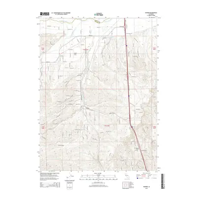
2015 Map of Hooker
USGS Topo · Published 2015About this map
Hooker serves as a central point in this transition zone between the northern Sacramento Valley and the rising terrain of the Cascade foothills. The landscape is defined by a series of south-flowing drainage systems, including Cottonwood Creek and the South Fork Cottonwood Creek, which have carved distinct patterns across the county line between Shasta and Tehama counties. The presence of the Anderson-Cottonwood Canal snaking across the northern half of the map illustrates the critical role of water management in this agricultural and pastoral region. To the west, the Flying N Ranch Airport provides a distinct aviation landmark among the network of rural roads such as Bowman Rd and Donovan Rd. Moving south toward the Central Valley, the terrain drops into Solomon Gulch and along the banks of Blue Tent Cr, showcasing the varied topography that transitions from flat valley floors to dissected upland ridges.
Find a feature on this map
113 named features on this map. Tap any name to fly to it.
Don’t see what you’re looking for? This feature index may not catch every label — zoom into the map to look around manually.
Map Details
Editions of this 2015 Hooker Map
This is the sole edition of this map. No revisions or reprints were ever made.
Other maps of this area

1890 · Red Bluff
USGS Topo · 1:250,000

1894 · Red Bluff
USGS Topo · 1:250,000

1905 · Tehama
USGS Topo · 1:62,500

1932 · Olinda
USGS Topo · 1:31,680

1935 · Olinda
USGS Topo · 1:31,680

1944 · Tuscan Buttes
USGS Topo · 1:62,500

1947 · Tuscan Buttes
USGS Topo · 1:62,500

1947 · Anderson
USGS Topo · 1:62,500

1948 · Anderson
USGS Topo · 1:62,500

1951 · Red Bluff East
USGS Topo · 1:24,000