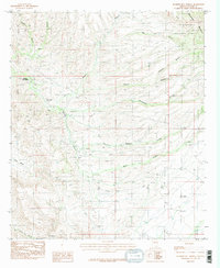
1985 Map of Hookers Hot Springs
USGS Topo · Published 1985About this map
Hookers Hot Springs sits at the heart of this high-desert landscape in Cochise County, where the topography transitions from the dramatic peaks of the Winchester Mountains to the broad expanse of Allen Flat. This 1980s-era record captures a network of vital water sources in a complex drainage system, including N O Spring, Riggs Seep, and V-F Springs. The map details the rugged intersection of private lands and the Coronado National Forest, revealing the isolated character of the region's ranching and spring-fed outposts.
Find a feature on this map
20 named features on this map. Tap any name to fly to it.
Don’t see what you’re looking for? This feature index may not catch every label — zoom into the map to look around manually.
Map Details
Editions of this 1985 Hookers Hot Springs Map
2 editions found
Other maps of this area

1943 · Dragoon
USGS Topo · 1:62,500

1943 · Winchester Mts.
USGS Topo · 1:62,500

1945 · Redington
USGS Topo · 1:62,500

1945 · Winchester Mts.
USGS Topo · 1:62,500

1945 · Happy Valley
USGS Topo · 1:62,500

1956 · Tucson
USGS Topo · 1:250,000

1957 · Redington
USGS Topo · 1:62,500

1957 · Winchester Mts.
USGS Topo · 1:62,500

1958 · Tucson
USGS Topo · 1:250,000

1958 · Happy Valley
USGS Topo · 1:62,500