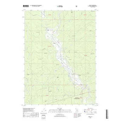
2018 Map of Hoopa
USGS Topo · Published 2018About this map
The Trinity River defines this portion of Humboldt County, winding through the Hoopa Valley where the community of Hoopa serves as a central hub. This terrain is characterized by steep ridges and peaks, including Telescope Peak and Captain John Mtn, with much of the land falling within the Six Rivers National Forest. The landscape reveals a legacy of naming tied to both the environment and early activity, with features like Sawmill Ridge, Hospital Ridge, and the Hoopa Airport situated along the river's path.
Find a feature on this map
74 named features on this map. Tap any name to fly to it.
Don’t see what you’re looking for? This feature index may not catch every label — zoom into the map to look around manually.
Map Details
Editions of this 2018 Hoopa Map
This is the sole edition of this map. No revisions or reprints were ever made.
Other maps of this area

1915 · Big Bar and Vicinity
USGS Topo · 1:250,000

1922 · Korbel
USGS Topo · 1:62,500

1922 · China Flat
USGS Topo · 1:62,500

1925 · Hoopa
USGS Topo · 1:125,000

1945 · Coyote Peak
USGS Topo · 1:62,500

1945 · Blue Lake
USGS Topo · 1:62,500

1948 · Weed
USGS Topo · 1:250,000

1950 · Weed
USGS Topo · 1:250,000

1951 · Blue Lake
USGS Topo · 1:62,500

1952 · Willow Creek
USGS Topo · 1:62,500