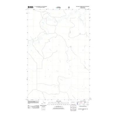
2011 Map of Hootowl Creek East
USGS Topo · Published 2011About this map
Beaver Creek and its many meandering tributaries define this portion of the North Dakota badlands in the early twenty-first century. This landscape in Pearl Township is marked by an intricate network of drainage systems, where Horse Creek and Hootowl Creek cut through the terrain to join larger waterways. The map illustrates a remote ranching or agricultural environment where movement is dictated by a handful of established routes, including Tescher Rd and Mosher Rd.
Find a feature on this map
11 named features on this map. Tap any name to fly to it.
Don’t see what you’re looking for? This feature index may not catch every label — zoom into the map to look around manually.
Map Details
Editions of this 2011 Hootowl Creek East Map
This is the sole edition of this map. No revisions or reprints were ever made.
Other maps of this area

1953 · Watford City
USGS Topo · 1:250,000

1957 · Watford City
USGS Topo · 1:250,000

1967 · Watford City
USGS Topo · 1:250,000

1970 · Eagle Draw
USGS Topo · 1:24,000

1974 · Hootowl Creek West
USGS Topo · 1:24,000

1974 · Trotters SE
USGS Topo · 1:24,000

1974 · West Twin Butte
USGS Topo · 1:24,000

1974 · Trotters
USGS Topo · 1:24,000

1974 · Roosevelt Creek West
USGS Topo · 1:24,000
1974 · Hootowl Creek SW
USGS Topo · 1:24,000