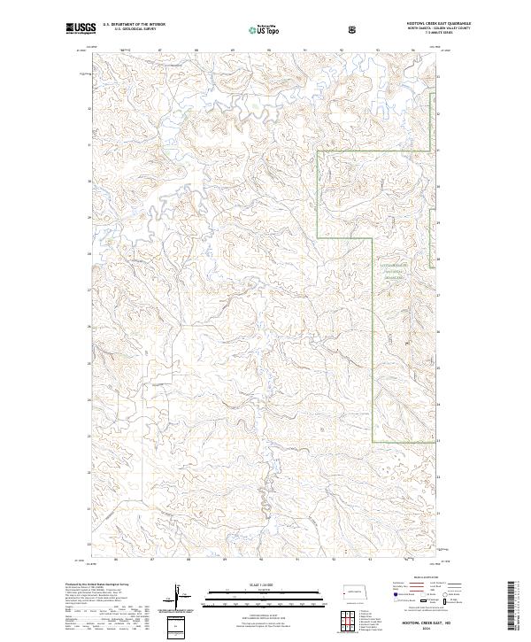
2024 Map of Hootowl Creek East
USGS Topo · Published 2024About this map
The Little Missouri National Grassland dominates this portion of Golden Valley County, where a complex network of drainages carves through the North Dakota badlands. The landscape is defined by the winding course of Beaver Creek and its various tributaries, including Hootowl Creek and Horse Creek in the northern sections. This 2024 survey illustrates the persistence of a sparsely populated ranching environment, where connectivity depends on isolated corridors like Tescher Rd and Mosher Rd. In the southern reaches, Elk Creek and Alkali Creek further articulate the rugged topography of the grassland. The map provides a clear look at the Public Land Survey System grid, with numerous sections and township lines such as t143n r104w and t144n r103w defining the administrative boundaries of this open range country.
Find a feature on this map
15 named features on this map. Tap any name to fly to it.
Don’t see what you’re looking for? This feature index may not catch every label — zoom into the map to look around manually.
Map Details
Editions of this 2024 Hootowl Creek East Map
This is the sole edition of this map. No revisions or reprints were ever made.
Other maps of this area

1953 · Watford City
USGS Topo · 1:250,000

1957 · Watford City
USGS Topo · 1:250,000

1967 · Watford City
USGS Topo · 1:250,000

1970 · Eagle Draw
USGS Topo · 1:24,000

1974 · Hootowl Creek West
USGS Topo · 1:24,000

1974 · Trotters SE
USGS Topo · 1:24,000

1974 · West Twin Butte
USGS Topo · 1:24,000

1974 · Trotters
USGS Topo · 1:24,000

1974 · Roosevelt Creek West
USGS Topo · 1:24,000
1974 · Hootowl Creek SW
USGS Topo · 1:24,000