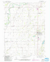
1968 Map of Hope
USGS Topo · Published 1988About this map
Flatrock River winds through the northwestern reaches of this Indiana landscape, where the county line between Shelby and Bartholomew counties meets. The area is defined by a dense network of agricultural settlements and family-named landmarks. The town of Hope stands as a primary hub, featuring the Hope Moravian Cemetery and Hauser High Sch. Several smaller communities like Flat Rock, Clifford, and St Louis Crossing are connected by a Railroad and an Old Grade, reflecting the importance of rail transport in the mid-20th century.
Find a feature on this map
55 named features on this map. Tap any name to fly to it.
Don’t see what you’re looking for? This feature index may not catch every label — zoom into the map to look around manually.
Map Details
Editions of this 1968 Hope Map
Other maps of this area

1942 · Columbus
USGS Topo · 1:125,000

1947 · Hope
USGS Topo · 1:24,000

1948 · Edinburg
USGS Topo · 1:24,000

1948 · Hope
USGS Topo · 1:24,000

1948 · Lewis Creek
USGS Topo · 1:24,000

1948 · Marietta
USGS Topo · 1:24,000

1950 · Edinburg
USGS Topo · 1:62,500

1953 · Cincinnati
USGS Topo · 1:250,000

1956 · Waldron
USGS Topo · 1:24,000

1957 · Cincinnati
USGS Topo · 1:250,000