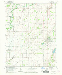
1968 Map of Hope
USGS Topo · Published 1970About this map
Flatrock River and the Penn Central railroad corridor define the rural character of this northern Bartholomew County landscape. The area is marked by a network of established settlements, including the town of Hope and the historically significant twin sites of St Louis Crossing and Old St Louis. Genealogists and local historians will find a high density of burial grounds and rural meeting places, such as Flat Rock Cemetery, Simmons Cemetery, and the United Separate Church near Northcliff. The landscape is characterized by a series of waterways, including Tough Creek, Haw Creek, and Clifty Creek, which flow through various townships like German and Flat Rock. From the residential grid of Clifford to the Gaging Station and Schaefer Lake, the map provides a look at the mid-century agricultural and civic infrastructure of this Indiana region.
Find a feature on this map
72 named features on this map. Tap any name to fly to it.
Don’t see what you’re looking for? This feature index may not catch every label — zoom into the map to look around manually.
Map Details
Editions of this 1968 Hope Map
Other maps of this area

1942 · Columbus
USGS Topo · 1:125,000

1947 · Hope
USGS Topo · 1:24,000

1948 · Edinburg
USGS Topo · 1:24,000

1948 · Hope
USGS Topo · 1:24,000

1948 · Lewis Creek
USGS Topo · 1:24,000

1948 · Marietta
USGS Topo · 1:24,000

1950 · Edinburg
USGS Topo · 1:62,500

1953 · Cincinnati
USGS Topo · 1:250,000

1956 · Waldron
USGS Topo · 1:24,000

1957 · Cincinnati
USGS Topo · 1:250,000