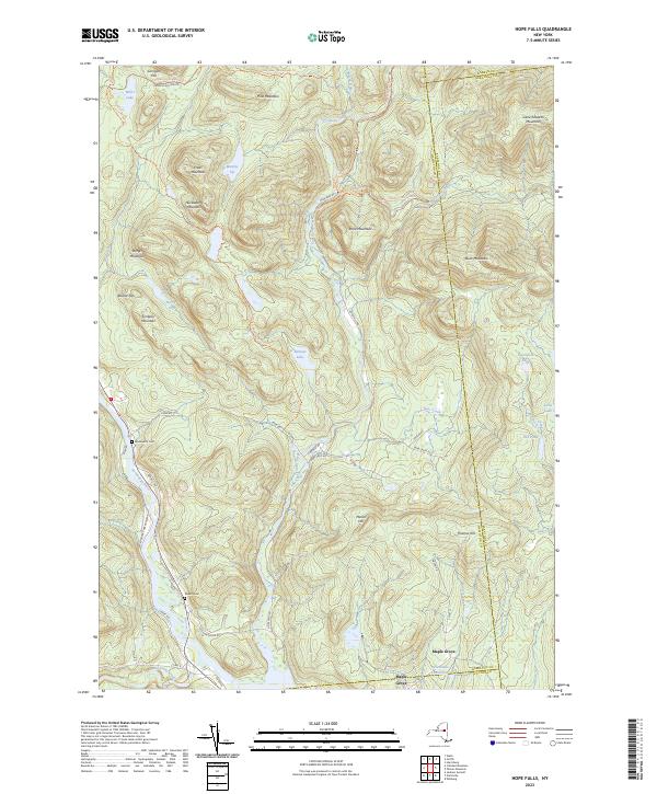
2023 Map of Hope Falls
USGS Topo · Published 2023About this map
The Sacandaga River and East Stony Creek carve through this high-elevation landscape within the Adirondack Park Preserve, where the settlement of Maple Grove sits near the southern boundary. This terrain is defined by a dense network of peaks including Buck Mountain, Pine Mountain, and Gene Edwards Mountain, connected by a web of trails such as the Wilcox Lake - Willis Lake Trl and East Stony Creek Trl. Genealogical interest is found in local landmarks like Wadsworth Cem and Willard Cem, which remain as markers of the area's early residency.
Find a feature on this map
61 named features on this map. Tap any name to fly to it.
Don’t see what you’re looking for? This feature index may not catch every label — zoom into the map to look around manually.
Map Details
Editions of this 2023 Hope Falls Map
This is the sole edition of this map. No revisions or reprints were ever made.
Other maps of this area

1899 · Broadalbin
USGS Topo · 1:62,500

1902 · Broadalbin
USGS Topo · 1:62,500

1903 · Gloversville
USGS Topo · 1:62,500

1907 · Lake Pleasant
USGS Topo · 1:62,500

1910 · Stony Creek
USGS Topo · 1:62,500

1943 · Gloversville
USGS Topo · 1:62,500

1945 · Edinburg
USGS Topo · 1:24,000

1945 · Northville
USGS Topo · 1:24,000
1945 · Jackson Summit
USGS Topo · 1:24,000
1946 · Edinburg
USGS Topo · 1:24,000