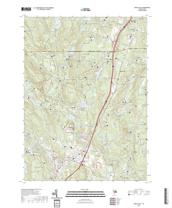
2024 Map of Hope Valley
USGS Topo · Published 2024About this map
Hope Valley and Wyoming anchor the southern reaches of this landscape, where the Wood River winds through a dense network of family cemeteries and historic mill sites. The prevalence of small, named burial grounds such as the Israel Lewis Cem and the John Foster Bitgood Lot Cem reflects the deep-rooted family landholdings characteristic of this part of Washington County. To the north, the terrain rises toward Penny Hill and Bald Hill, interspersed with water bodies like Browning Mill Pond and Deep Pond. The map captures the meeting of rural hamlets like Nooseneck and Barberville with extensive conservation areas including the Mount Tom Club Wildlife Marsh. This region maintains its character as a corridor of small settlements and rugged forest, where names like Buttonwood Corner mark the intersections of a long-established road network.
Find a feature on this map
217 named features on this map. Tap any name to fly to it.
Don’t see what you’re looking for? This feature index may not catch every label — zoom into the map to look around manually.
Map Details
Editions of this 2024 Hope Valley Map
This is the sole edition of this map. No revisions or reprints were ever made.
Other maps of this area

1889 · Stonington
USGS Topo · 1:62,500

1889 · Charlestown
USGS Topo · 1:62,500

1889 · Moosup
USGS Topo · 1:62,500

1890 · Kent
USGS Topo · 1:62,500

1893 · Moosup
USGS Topo · 1:62,500

1893 · Stonington
USGS Topo · 1:62,500

1894 · Kent
USGS Topo · 1:62,500

1919 · Charlestown
USGS Topo · 1:62,500

1920 · Moosup
USGS Topo · 1:62,500

1921 · Charlestown
USGS Topo · 1:62,500