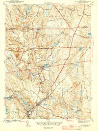
1943 Map of Hope Valley
USGS Topo · Published 1943About this map
The Wood River flows through a series of mill-pond settlements and rural crossings during the early 1940s, defining the industrial and social character of this part of southern Rhode Island. In Hope Valley, the river feeds into Locustville Pond, while upstream, smaller hamlets like Arcadia and Barberville are centers of local activity along the Roaring Brook and its tributaries. The landscape is dotted with the infrastructure of a settled countryside, featuring institutions like the West Exeter Ch and several district schools including Old Bates Sch and the Woody Hill Sch.
Find a feature on this map
80 named features on this map. Tap any name to fly to it.
Don’t see what you’re looking for? This feature index may not catch every label — zoom into the map to look around manually.
Map Details
Editions of this 1943 Hope Valley Map
2 editions found
Other maps of this area

1889 · Stonington
USGS Topo · 1:62,500

1889 · Charlestown
USGS Topo · 1:62,500

1889 · Moosup
USGS Topo · 1:62,500

1890 · Kent
USGS Topo · 1:62,500

1893 · Moosup
USGS Topo · 1:62,500

1893 · Stonington
USGS Topo · 1:62,500

1894 · Kent
USGS Topo · 1:62,500

1919 · Charlestown
USGS Topo · 1:62,500

1920 · Moosup
USGS Topo · 1:62,500

1921 · Charlestown
USGS Topo · 1:62,500