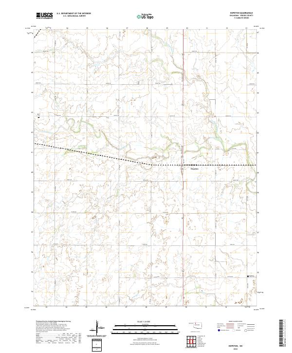
2022 Map of Hopeton
USGS Topo · Published 2022About this map
Hopeton sits as the central settlement in this Woods County landscape, anchored along the north-south transit corridor of Main Street and College Boulevard. The terrain is defined by the winding course of Little Eagle Chief Cr, which meanders through the northern and eastern sections of the quadrangle. This 2022 survey captures a rural Oklahoma environment organized by a strict grid of section lines, where agriculture and open land dominate the local geography. The map provides a contemporary view of the region's established road network, including the intersection of Dewey Road and Custer Road, illustrating the enduring spatial layout of these western Oklahoma farming communities.
Find a feature on this map
2 named features on this map. Tap any name to fly to it.
Don’t see what you’re looking for? This feature index may not catch every label — zoom into the map to look around manually.
Map Details
Editions of this 2022 Hopeton Map
This is the sole edition of this map. No revisions or reprints were ever made.
Other maps of this area

1955 · Woodward
USGS Topo · 1:250,000

1958 · Woodward
USGS Topo · 1:250,000

1969 · Dacoma
USGS Topo · 1:24,000

1969 · Tegarden SE
USGS Topo · 1:24,000

1969 · Alva SE
USGS Topo · 1:24,000

1969 · Dacoma SW
USGS Topo · 1:24,000

1969 · Hopeton
USGS Topo · 1:24,000

1969 · Avard
USGS Topo · 1:24,000

1969 · Waynoka East
USGS Topo · 1:24,000
1969 · Alva
USGS Topo · 1:24,000