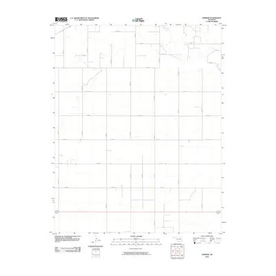
2010 Map of Hopkins
USGS Topo · Published 2010About this map
Goff Creek meanders through the northern and eastern portions of this High Plains landscape in Cimarron County, providing the primary hydrological relief in an otherwise strictly gridded agricultural expanse. This 2010 survey illustrates a highly organized section of the Oklahoma Panhandle, where the land is partitioned by an extensive network of numbered and lettered section-line roads, such as Co Rd J and Road N. The map reflects a modern era of rural land management where traditional town centers are absent, replaced by large-scale farming and ranching operations. Significant routes like E0150 Rd and N0510 Rd intersect across the terrain, showing the systematic infrastructure required to service this remote cattle and wheat country near the state's western edge.
Find a feature on this map
23 named features on this map. Tap any name to fly to it.
Don’t see what you’re looking for? This feature index may not catch every label — zoom into the map to look around manually.
Map Details
Editions of this 2010 Hopkins Map
This is the sole edition of this map. No revisions or reprints were ever made.
Other maps of this area

1954 · Perryton
USGS Topo · 1:250,000

1954 · Dalhart
USGS Topo · 1:250,000

1958 · Perryton
USGS Topo · 1:250,000

1958 · Dalhart
USGS Topo · 1:250,000

1962 · Dalhart
USGS Topo · 1:250,000

1971 · Griggs NE
USGS Topo · 1:24,000

1971 · Sturgis
USGS Topo · 1:24,000

1971 · Hopkins
USGS Topo · 1:24,000

1971 · Keyes East
USGS Topo · 1:24,000

1971 · Griggs NW
USGS Topo · 1:24,000