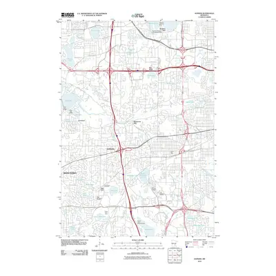
2010 Map of Hopkins
USGS Topo · Published 2010About this map
Minnehaha Creek winds through this suburban landscape, connecting a series of smaller lakes and wetlands between Hopkins and Minnetonka. The map illustrates a densely developed corridor where residential neighborhoods are integrated with unique aviation and recreation features. Notably, the area supports multiple water-based landing sites, including the Peterson Seaplane Base on Medicine Lake and the Bryant Lake Seaplane Base to the south.
Find a feature on this map
71 named features on this map. Tap any name to fly to it.
Don’t see what you’re looking for? This feature index may not catch every label — zoom into the map to look around manually.
Map Details
Editions of this 2010 Hopkins Map
This is the sole edition of this map. No revisions or reprints were ever made.
Other maps of this area

1896 · Minneapolis
USGS Topo · 1:62,500

1901 · Minneapolis
USGS Topo · 1:62,500

1902 · Anoka
USGS Topo · 1:62,500

1905 · Minnetonka
USGS Topo · 1:62,500

1907 · Minnetonka
USGS Topo · 1:62,500

1909 · Rockford
USGS Topo · 1:62,500

1952 · Minneapolis North
USGS Topo · 1:24,000

1952 · Minneapolis South
USGS Topo · 1:24,000

1953 · Saint Paul
USGS Topo · 1:250,000

1953 · Stillwater
USGS Topo · 1:250,000