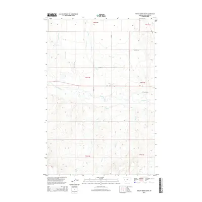
2014 Map of Hopley Creek South
USGS Topo · Published 2014About this map
The Musselshell River meanders across this Wheatland County landscape, defining the central drainage basin of a region deeply tied to Montana's ranching and irrigation history. Water management is a primary feature of the terrain, evidenced by the Twodot Canal which cuts through the northern sections to redirect the flow of Mexican John Cr and Hopley Cr. This 2014 survey documents the enduring infrastructure of the High Plains, where remote roads like Mexican John Rd and Muskrat Trl connect isolated ranchlands and section lines. From the northern heights near Wheatland Co Rd to the southern reaches of Mud Cr and McVey Cr, the map illustrates a landscape of coulees and creeks, including the distinct Dresback Coulee east of the river.
Find a feature on this map
22 named features on this map. Tap any name to fly to it.
Don’t see what you’re looking for? This feature index may not catch every label — zoom into the map to look around manually.
Map Details
Editions of this 2014 Hopley Creek South Map
This is the sole edition of this map. No revisions or reprints were ever made.
Other maps of this area

1886 · Little Belt Mts.
USGS Topo · 1:250,000

1889 · Big Snowy Mountain
USGS Topo · 1:250,000

1893 · Big Snowy Mountain
USGS Topo · 1:250,000

1894 · Little Belt Mts.
USGS Topo · 1:250,000

1897 · Little Belt Mts.
USGS Topo · 1:250,000

1898 · Little Belt Mts.
USGS Topo · 1:250,000

1902 · Little Belt Mts.
USGS Topo · 1:250,000

1948 · White Sulphur Springs
USGS Topo · 1:250,000

1954 · Roundup
USGS Topo · 1:250,000

1958 · Roundup
USGS Topo · 1:250,000