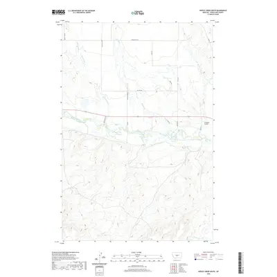
2020 Map of Hopley Creek South
USGS Topo · Published 2020About this map
The Musselshell River meanders across this central Montana landscape, creating a fertile riparian corridor through a region of high plains and coulees. Irrigation infrastructure, such as the Twodot Canal, reflects the agricultural necessity of moving water from the river to the surrounding ranch lands. This water management is a defining characteristic of Wheatland County, where the economy centers on cattle and hay production facilitated by an extensive network of creeks including Mexican John Cr and Hopley Cr.
Find a feature on this map
23 named features on this map. Tap any name to fly to it.
Don’t see what you’re looking for? This feature index may not catch every label — zoom into the map to look around manually.
Map Details
Editions of this 2020 Hopley Creek South Map
This is the sole edition of this map. No revisions or reprints were ever made.
Other maps of this area

1886 · Little Belt Mts.
USGS Topo · 1:250,000

1889 · Big Snowy Mountain
USGS Topo · 1:250,000

1893 · Big Snowy Mountain
USGS Topo · 1:250,000

1894 · Little Belt Mts.
USGS Topo · 1:250,000

1897 · Little Belt Mts.
USGS Topo · 1:250,000

1898 · Little Belt Mts.
USGS Topo · 1:250,000

1902 · Little Belt Mts.
USGS Topo · 1:250,000

1948 · White Sulphur Springs
USGS Topo · 1:250,000

1954 · Roundup
USGS Topo · 1:250,000

1958 · Roundup
USGS Topo · 1:250,000