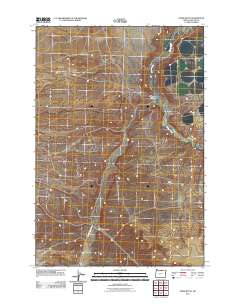
2011 Map of Horn Butte
USGS Topo · Published 2011About this map
Horn Butte stands as a prominent topographical feature in this high-desert region of Gilliam County. The landscape is defined by the significant drainage of Willow Creek, which carves through the eastern portion of the map, and the deep incisions of Eightmile Canyon and Fourmile Canyon further west. Transportation in this arid stretch is limited to a small network of rural routes, including Rhea Rd and Eightmile Canyon Rd, which follow the natural contours of the drainages. The map reveals the relationship between water and accessibility, where roads often align with the canyon floors or creek beds, serving the sparse agricultural or grazing lands characteristic of the Oregon interior.
Find a feature on this map
6 named features on this map. Tap any name to fly to it.
Don’t see what you’re looking for? This feature index may not catch every label — zoom into the map to look around manually.
Map Details
Editions of this 2011 Horn Butte Map
This is the sole edition of this map. No revisions or reprints were ever made.
Other maps of this area

1906 · Blalock Island
USGS Topo · 1:125,000

1908 · Blalock Island
USGS Topo · 1:125,000

1916 · Arlington
USGS Topo · 1:125,000

1953 · Pendleton
USGS Topo · 1:250,000

1953 · The Dalles
USGS Topo · 1:250,000

1956 · The Dalles
USGS Topo · 1:250,000

1956 · Pendleton
USGS Topo · 1:250,000

1957 · The Dalles
USGS Topo · 1:250,000

1962 · Alderdale
USGS Topo · 1:24,000

1962 · Heppner Junction
USGS Topo · 1:24,000