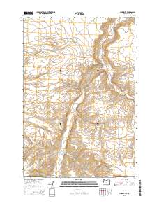
2014 Map of Horn Butte
USGS Topo · Published 2014About this map
Hurlburt Flats and the prominent summit of Horn Butte anchor this section of North Central Oregon, where the landscape is defined by deep drainage systems. The Heppner Hwy winds alongside Willow Cr, a primary watercourse that cuts through the plateau. This 2014 survey illustrates a rural transportation network that follows the natural contours of the land, including Eightmile Rd and Fourmile Rd, which provide access to the expansive Eightmile Canyon and Fourmile Canyon. The map reveals how local transit remains tied to these geographic features, with named routes like Sullivan Rd and Rhea Ln connecting remote agricultural or ranching tracts within the townships of t3n r22e and t2n r22e.
Find a feature on this map
13 named features on this map. Tap any name to fly to it.
Don’t see what you’re looking for? This feature index may not catch every label — zoom into the map to look around manually.
Map Details
Editions of this 2014 Horn Butte Map
This is the sole edition of this map. No revisions or reprints were ever made.
Other maps of this area

1906 · Blalock Island
USGS Topo · 1:125,000

1908 · Blalock Island
USGS Topo · 1:125,000

1916 · Arlington
USGS Topo · 1:125,000

1953 · Pendleton
USGS Topo · 1:250,000

1953 · The Dalles
USGS Topo · 1:250,000

1956 · The Dalles
USGS Topo · 1:250,000

1956 · Pendleton
USGS Topo · 1:250,000

1957 · The Dalles
USGS Topo · 1:250,000

1962 · Alderdale
USGS Topo · 1:24,000

1962 · Heppner Junction
USGS Topo · 1:24,000