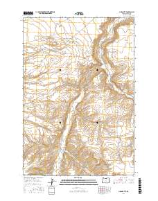
2017 Map of Horn Butte
USGS Topo · Published 2017About this map
Horn Butte rises above the high desert of Gilliam County, anchoring a landscape defined by deep drainages and expansive plateau flats. The eastern portion of this territory is carved by Willow Cr, which parallels Willow Creek Rd as it winds through the valley floor. To the north, the broad expanse of Hurlburt Flats suggests the open agricultural or grazing character of the region, while the terrain to the west is dominated by the intricate topography of Eightmile Canyon and Fourmile Canyon. The road network, including Sullivan Rd and Rhea Ln, traces the natural contours of the land, connecting isolated ranch sites and providing access through the rugged breaks of the Columbia Plateau during the early twenty-first century.
Find a feature on this map
13 named features on this map. Tap any name to fly to it.
Don’t see what you’re looking for? This feature index may not catch every label — zoom into the map to look around manually.
Map Details
Editions of this 2017 Horn Butte Map
This is the sole edition of this map. No revisions or reprints were ever made.
Other maps of this area

1906 · Blalock Island
USGS Topo · 1:125,000

1908 · Blalock Island
USGS Topo · 1:125,000

1916 · Arlington
USGS Topo · 1:125,000

1953 · Pendleton
USGS Topo · 1:250,000

1953 · The Dalles
USGS Topo · 1:250,000

1956 · The Dalles
USGS Topo · 1:250,000

1956 · Pendleton
USGS Topo · 1:250,000

1957 · The Dalles
USGS Topo · 1:250,000

1962 · Alderdale
USGS Topo · 1:24,000

1962 · Heppner Junction
USGS Topo · 1:24,000